ARTIFICIAL INTELLIGENCE
WeatherNext and the Meaning of Probabilistic Weather
WeatherNext 3 arrived in September 2026 with satellite inputs and hourly updates. Explore ensemble forecasts, cyclone evidence, and the limits of a probability map.
Research checked
Newest cited publication
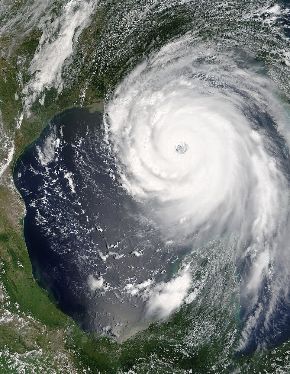
Terra observed Hurricane Katrina on August 28, 2005. The satellite image provides weather context rather than a forecast generated by WeatherNext.
Jeff Schmaltz, MODIS Rapid Response Team, NASA/GSFC · Image source · Public domain

A forecast is useful partly because it can describe more than one future. A line on a weather map invites a single-outcome interpretation, but decisions about storms, electricity, and transport depend on uncertainty around that line. WeatherNext's 2026 developments make this especially clear. A peer-reviewed cyclone study appeared in Nature on August 6; Google then announced WeatherNext 3 on September 3, accompanied by a new preprint. These are related advances with different evidence and different scopes. Reading them together shows why faster predictions, more frequent updates, and more ensemble members answer distinct questions rather than adding up to a promise of certainty.
WeatherNext 3 changes what enters the model
The September 2026 announcement describes using low-latency satellite observations alongside other information to issue new forecasts every hour. It also describes outputs at different spatial resolutions: temperature and moisture at five kilometers, other surface variables at ten kilometers, and atmospheric variables at twenty-five kilometers. These distinctions matter. Calling everything a five-kilometer forecast would overstate the spatial detail of outputs that use a coarser representation.
The accompanying September 3 arXiv preprint explains the motivation. Models trained and initialized only from analysis data can inherit limitations of those analyses and cannot directly exploit fresh observations. WeatherNext 3 adds satellite information and learns additional observation-based targets, including sparse station measurements. The paper presents improved probabilistic forecasting and more flexible outputs. It was a preprint at the cited record, so its status differs from the separate August Nature cyclone article. A product announcement and a peer-reviewed study should remain distinguishable even when they describe the same research program.
A new forecast each hour is not the same as hourly output
Google's release notes record WeatherNext 3 as an operational platform update on August 31, 2026, while the public research announcement followed on September 3. They describe hourly initialization and data delivery, including an ensemble product. These dates need not conflict: a platform's recorded deployment and its public research announcement can occur on different days. Recording which event a date describes is more informative than silently choosing one as the only release date.
There are at least three clocks in a forecasting system. One determines how often a new forecast starts. Another determines the time spacing between predictions within that forecast. A third measures when the result reaches a user. Imagine a forecast initialized at noon with an output for every subsequent hour. It can still become stale if a fresh run is not available until evening. Conversely, rapidly launching a coarse forecast does not create detailed short-interval output. A useful operational evaluation should record all three clocks, because the person making a decision receives data at a particular real time, not at the ideal timestamp in a research diagram.
An ensemble represents alternatives, not a vote by observers
WeatherNext 2's November 2025 release describes a Functional Generative Network, or FGN, that injects noise within the model to generate coherent alternative forecasts. It distinguishes marginal quantities, such as temperature at one location, from joint behavior spanning variables and places. That distinction remains central to probabilistic forecasting: separate plausible values are not enough if they combine into an implausible weather system.
Consider a fictional pair of neighboring sites that almost always become hot together. A method that independently flips a coin for heat at each site could match each site's fifty-percent marginal probability while badly misrepresenting regional heat. It would predict mismatched conditions too often. An ensemble intended for power-grid planning must preserve the relevant dependence, not just the separate averages. Generated members are also not independent measurements of the real atmosphere. They are samples from a model's learned distribution, so a thousand members can share a systematic error. Increasing their number improves sampling of that distribution; it cannot guarantee that the distribution is correct.
The cyclone result tests more than a track
The August 6, 2026 Nature paper evaluates WeatherNext Cyclones on storm track, intensity, and wind structure, using cases from 2023 through 2025. It reports an average lead-time advantage of a day or more over leading operational comparators. Training combines global atmospheric analysis with expert-curated cyclone records. The study's co-training formulation predicts a global atmospheric state and cyclone-specific information together, instead of asking a coarse global field alone to supply every detail of an intense storm.
The lead-time claim is easy to misread. It compares forecast accuracy at different horizons across an evaluation; it does not mean every storm receives exactly one additional safe day, or that a three-day forecast is always correct. A particular storm can remain difficult even when the average improves. Moreover, track, peak wind, and the geographic extent of hazardous winds matter differently for different locations. A model that places the center accurately but estimates the wind field poorly could still mislead a downstream assessment. Separating these measures preserves the practical meaning of the reported advance.
More members help with rare outcomes, within limits
The August institutional release explains that WeatherNext's cyclone ensemble was expanded from fifty to one thousand members, making rare scenarios easier to inspect. It also notes that the system supports human forecasters and directs readers to national meteorological agencies for official forecasts and warnings. The model is guidance within a wider forecasting process. Its numerical output is not automatically an official public-safety instruction.
An illustrative probability calculation shows both the benefit and the limit. If a particular event truly has model probability one percent, fifty independent samples have an approximately 39.5 percent chance of showing it at least once: one minus 0.99 to the fiftieth power. With one thousand independent samples, that chance exceeds 99.99 percent. These are sampling calculations under stated assumptions, not an evaluation of actual WeatherNext member independence or real-world event probability. They explain why a larger ensemble can reveal a model's tail scenarios. They also explain why observing several alarming members cannot by itself establish the correct frequency of the event outside the model.
The forecast needs a history of calibrated statements
A probabilistic forecast should be judged by repeated, comparable cases. If events assigned a twenty-percent probability happen about one fifth of the time, that supports calibration for the evaluated setting. Calibration alone is insufficient: a forecast that always repeats a broad background frequency may miss useful distinctions between individual situations. Researchers therefore need measures that reward both honest uncertainty and informative concentration, as well as checks of important joint events.
The WeatherNext studies use probabilistic scoring alongside task-specific evaluations. My interpretation is that the most useful next comparison would preserve operational timing, include geographically diverse conditions, and examine reliability where decisions are sensitive to rare outcomes. It would compare observation sources with care, because a satellite precipitation estimate and a rain gauge do not observe exactly the same thing. It would report revisions and failed cases as openly as average gains. WeatherNext 3's combination of recent observations, flexible output, and rapid updates is a substantial research direction. Its value ultimately lies in making uncertainty more measurable and decisions better informed, rather than making uncertainty disappear.
An additional distinction is between issuing a probability and choosing an action. Two organizations can receive the same forecast and respond differently because their costs and responsibilities differ. A maintenance team with a flexible schedule and an emergency service do not share the same decision problem. Improving the forecast helps both, but it does not replace their separate judgments. Research that links forecast skill to decisions should state those decision assumptions explicitly instead of treating a lower average error as an automatic measure of social benefit.
Sources & further reading
Primary papers, project documentation, and research releases used in this article. Publication dates below refer to the sources themselves.
- Introducing WeatherNext 3, our most advanced and accurate global weather AI modelGooglePublished Checked
- WeatherNext 3: Increasing resolution and performance of global weather models with raw observationsarXivPublished Checked
- WeatherNext release notesGoogle for DevelopersChecked
- WeatherNext 2: Our most advanced weather forecasting modelGooglePublished Checked
- Operational tropical cyclone forecasting with AINaturePublished Checked
- WeatherNext: AI model achieves breakthrough in forecasting cyclonesGoogle DeepMindPublished Checked
FOLLOW THE QUESTION
Study engineering foundations